
5 excursions in the Tuscan-Emilian Apennines
Five itineraries to discover the natural beauty of the National Park with your children
Whether you are seeking out cool summer spots for your family, breathtaking views, or an easy approach to the mountains with your children, the Appennino Tosco-Emiliano with its National Park and UNESCO Biosphere Reserve is an optimal choice.
Indeed, there is no shortage of easy hikes and conveniently accessible places that, with minimum preparation, extend the itinerary along some truly remarkable variants for an ever more informed approach to the mountains.
Here are five itineraries to discover the natural beauty of the park and the Lunigiana together with your children ...
-
1.Lagastrello Pass - Ring of Lake Paduli and Lake Squincio
-
2.Cerreto Pass - Excursion to Ospedalaccio Pass and Secchia Springs
-
3.Brattello Pass - Brattello Forest - Borgallo Pass
-
4.Cisa Pass and Cirone Pass ridge - Mount Valoria and Mount Fontanini
-
5.Logarghena Meadows
Lagastrello Pass - Ring of Lake Paduli and Lake Squincio

The starting point of this itinerary is the Lagastrello Pass, which can be reached via the SP74 road, passing through Aulla and Licciana Nardi.
Once you reach the Pass and after driving along the shore of the Lake Paduli water basin, you can leave your car near the dam. Enjoy the path around the lake, among lush pastures and majestic forests, often watched by a herd of Comano horses in the wild. For those who wish to make a walk, it is possible to reach the Squincio Lake basin and immerse themselves even further into the Apennine wilderness.
The itinerary takes a total of 2 hours, while more trained families can even include a climb to the City of Sarzana Refuge. The return trip can be an excellent opportunity to discover the beautiful villages of Tavernelle, Apella or Comano, with its giant bench.
Cerreto Pass - Excursion to Ospedalaccio Pass and Secchia Springs

The starting point of this itinerary is Cerreto Pass, which can be reached via the SS63 from Aulla and Fivizzano.
Leaving the car right at the Pass, we enter the trail in the direction of the Ospedalaccio Pass, crossing numerous sinkholes, resembling lunar craters and glimpsing the chalk formations of the Secchia valley, up to the Bismantova Stone. With an easy hike of about two hours, you reach the Ospedalaccio Pass, another historic Apennine gateway, where a hospice once stood, and today the French state boundary stone from the Napoleonic era still stands.
Those in better shape can continue to the Secchia springs, otherwise the path easily leads back to the Cerreto Pass, crossing the Lombardi path coming from Sassalbo just at a convenient picnic area. Just before the Pass, you skirt Lungo Lake and Padule Lake, dam lakes that bear witness to the glacial modeling of this area.
The restaurants at Cerreto Pass and Cerreto Lakes are a convenient and interesting way to end the itinerary.
Brattello Pass - Brattello Forest - Borgallo Pass

The starting point of this itinerary is Brattello Pass, which can be reached via the SP39 from Pontremoli.
You leave your car at the Pass and then head out to explore the Brattello forest complex. Following the E1 trail signs, one easily reaches a first picnic area, then a second one, completely set up inside a state-owned fir forest. From here the itineraries are multiple, comfortable dirt roads and mtb trails of the Lunigiana Bike Area cross the forest complex, leading to the discovery of the ruins of numerous "huts", until continuing along the Apennine ridge to the Borgallo pass. From the second picnic area starts an interesting ring around Mount Forni that altogether in about two and a half hours covers a section of the "Via degli Antichi passi" (Path of the Ancient Passes), just where the boundary stones still testify to the 1828 border between the Grand Duchy of Tuscany and Parma.
On the way back, the villages of Braia, Bratto, Grondola and Traverde are worth a stop.
Cisa Pass and Cirone Pass ridge - Mount Valoria and Mount Fontanini

There are two starting points for discovering the ridge that connects the Cisa Pass and the Cirone Pass: the Cisa Pass precisely reachable from Pontremoli via the SS62 or the Cirone Pass, also reachable from Pontremoli along the SP42.
Starting from the Cisa Pass, which is certainly better served with two refreshment points, one can make a brief stop at the church of the Madonna della Guardia (Our Lady of the Guard), and then climb from the opposite side of the road the ridge that in about an hour leads to the summit of Mount Valoria, with a picnic area and breathtaking views of Lunigiana. Very interesting and certainly wilder is the itinerary that starts from the Cirone Pass and, in about an hour and thirty crossing beech forests and grassy pastures, reaches first Mount Borgognone, from whose slopes the Magra River originates, and then Mount Fontanini.
A real ride between Tuscany and Emilia Romagna, which can end worthily with the rediscovery of stupendous villages, Montelungo, Gravagna and Pracchiola, or with a dip in the basin of the upper Magra, the Piscio di Pracchiola or Palino Lake above all.
Logarghena Meadows

The starting point of this hike is precisely the Logarghena Meadows, reachable by car from Filattiera and Pontremoli.
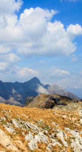
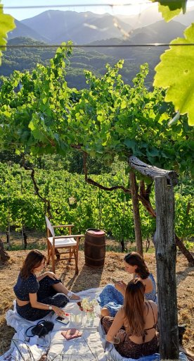
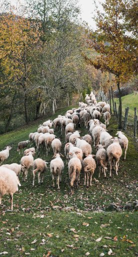
The Meadows are wide Apennine pastures, representing a real panoramic balcony over Lunigiana, as well as summer pastures of flocks and shepherds who still do transhumance here to obtain excellent dairy products. It is a bucolic and relaxing place that still recalls ancient traditions of pastoralism and days spent with the family with a tablecloth on the grass or a picnic towel. There are many points of access to the Logarghena Meadows, so there are also several itineraries on foot through agro-silvo-pastoral roads that lead up to Enrico Mattei Refuge, a possible destination for more trained families.
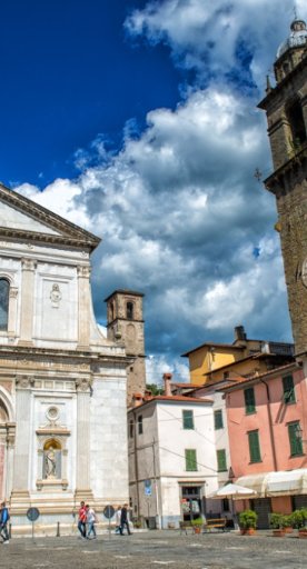
Not to be missed on the way back is a stop to discover the beautiful villages of Rocca Sigillina and Serravalle.


