
Things you should know about the Tuscan mountains
Skiing, hiking, mountain biking, extreme sports... or simply relax!
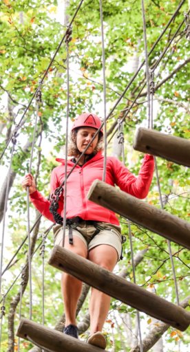
Tuscany has it all and the stunning mountainous landscape is the cherry on the cake of the region’s attractions. The mountains offer a range of magical holiday options, from skiing to hiking, mountain biking to extreme sports, and also the chance to have a well-deserved rest at a wonderful spa no matter the season. The splendour of Tuscany’s mountains will never perish and the memory of their sight will always be in your heart. Here is a list of Tuscan mountains that will suit your wishes.
-
1.The Apuan Alps
-
2.Monte Pisano
-
3.The Pistoia Mountains
-
4.The Chianti Mountains
-
5.The Colline Metallifere
-
6.Monte Cetona
-
7.Monte Morello
-
8.Monte Amiata
The Apuan Alps

The Alpi Apuane, as they are known in Italian, are a smaller chain of mountains that form part of the larger Apennine range, situated in northern Tuscany. The chain is located between the valleys of the Serchio and Magra rivers, between the Garfagnana and the Lunigiana in the north-west and the Apuan Riviera and Versilia in the south-west. The Apuan Alps Park covers approximately 20,598 hectares, of which the highest point is Mount Pisanino with an altitude of 1947 metres. In the past, the Apuan Alps were seen as precarious mountains, considered inaccessible, but today the territory is of great interest for many reasons: for the presence of marble quarries (one of the largest and oldest deposits of marble in the world, extracting marble since the Roman times, and was also later used by Michelangelo for his sculptures), for the opportunity to explore the nature of the countryside as well as participate in many unique and interesting excursions… even speleology! The Apuan Alps boast a diverse flora influenced by several factors, thanks especially to location and climate and the geological nature of the mountains. The mountains closer to the sea harbour Mediterranean vegetation, amongst which holm oak, myrtle and maritime pine grow over 600 meters above sea level. The inner Apuan Alps are covered with oak, hornbeam and turkey, largely replaced by man with chestnut trees. Troupes of tourists visit the Apuan Alps each year, prompting the creation of many walking trails and stop-off points scattered about the mountains, which are managed by the local CAI (Club Alpino Italiano or the senior Italian alpine club). On the Apuan Alps there are three possible multi-day hikes to take part in, each varying in duration and difficulty.
Monte Pisano

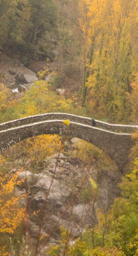
Mount Pisano, also known as Monti Pisani, is a mountain range that divides Pisa and Lucca. The mountains of the Monte Pisano are all shorter than 1000 m, with some resembling hills. The highest mountain is Mount Serra (917 m). The territory of Monti Pisani includes the towns Buti, Calci, San Giuliano Terme, Vicopisano, Vecchiano, Lucca and Capannori. This area comprises many medieval villages and remains of fortifications, along with other interesting places., such as the Rocca della Verruca, the Calci Charterhouse, the Medici aqueduct which stretches from Asciano to Pisa, the remains of the Roman aqueduct in Caldaccoli, and more. If you visit Monte Pisano make sure to taste the local olive oil, as well as the chestnuts from the woods of Molina di Quosa, which are unusual and famous for growing at a low altitude.
The Pistoia Mountains

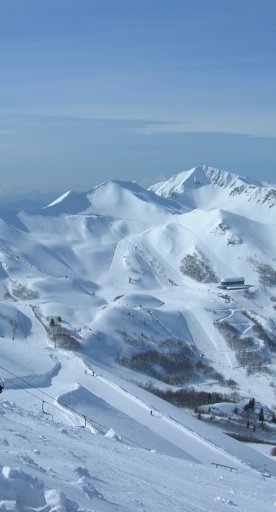
The Pistoia Mountains occupy a large area in north and north-west Pistoia, on the southern ridge of the Apennines. To the northwest and the north they border the Emilia Romagna region. The highest peaks are the Corno alle Scale (1,945 m above sea level) and the Alpe Tre Potenze. The Pistoia Mountains cover the "mountain" municipalities of Abetone, Cutigliano, Marliana, Piteglio, San Marcello Pistoiese, Sambuca Pistoiese and Pescia, Pistoia and Montale. The chain covers a total of 53,767 hectares, more than a half of the Province of Pistoia. The area enjoys landscapes of forest, conifers, chestnut trees and pastures and blueberries over 1500 m above sea level. This is the coldest area of Tuscany, with temperatures that in winter often don’t rise above zero degrees. Summer temperatures can get to as high as 30 degrees, which then fall to cooler temperatures at night. . The range possesses a diverse fauna which includes several species of birds and birds of prey, marmots, deer, fallow deer, fox, wild boar, martens and wolves. From November to March, the Pistoia Mountains are caked in a rich white snow and are home to some of the most famous ski resorts in Italy, including Abetone and Doganaccia di Cutigliano, each varying in difficulty, ranging from training camps to black slopes, which are recommended for more confident skiers. Other sports you can practise in the Pistoia Mountains are snowshoeing, Nordic walking, snowboard, bobsledding and, during the summer, mountain hiking, downhill, mountain biking and more. Undergoing restorations to strengthen cultural and natural heritage is the Montagna Pistoiese EcoMuseum, an area museum which includes many thematic areas, from the proto-industrial activities to those of everyday life.
The Chianti Mountains

The Chianti Mountains are a small mountain range located between Florence, Siena and Arezzo, which to the east border Valdarno and the Val di Chiana. At the foot of this small mountain range are the infamous rolling Chianti hills. The peak is Monte San Michele (893 m above sea level) in Greve,Chianti. The territory, largely characterized by cypresses, is rich in river sources. Situated high up on the hilltops are many castles with towers that were once the homes of lords, and fortresses built to defend attacks by mercenaries. The largely hilly area is involved in the production of Chianti, DOCG red wine.
The Colline Metallifere
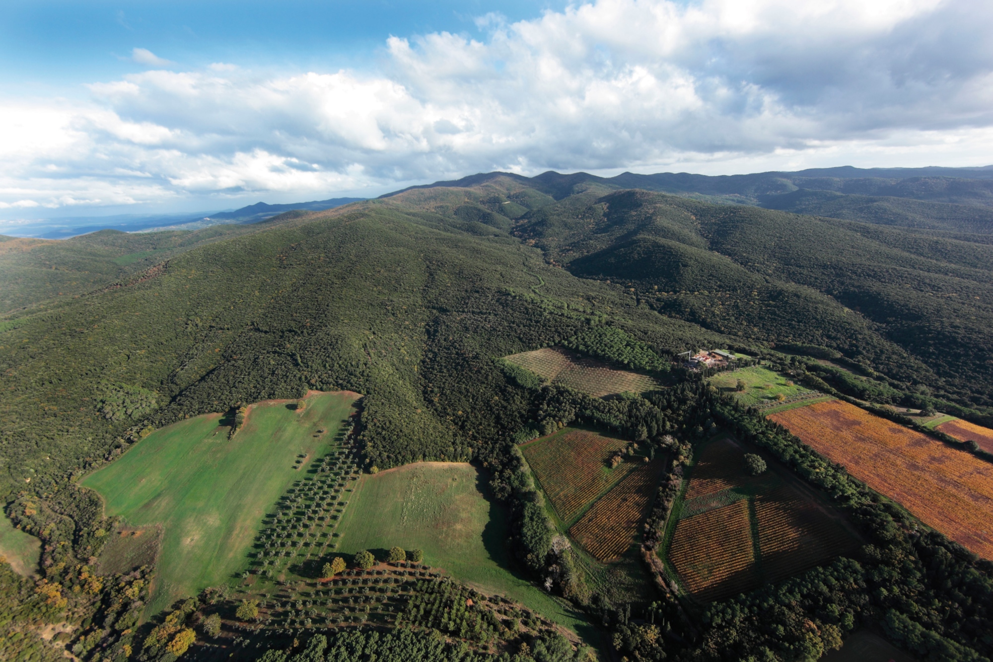
The Colline Metallifere, are the largest hill and mountain range in the Tuscan Anti-Appennines (Antiappennini), located in the western part of Tuscany and running through four provinces: the southeast part of Livorno, the southern part of Pisa, the southwestern part of Siena and the north-western part of Grosseto. The peak is Cornate di Gerfalco (1.060 m s.l.m.). Excluding the Poggio di Montieri and Cornate di Gerfalco peaks, that are both over 1,000 m, large part of the area is hilly and rich in local minerals and the area between Pisa and Grosseto is famous for its geothermal energy. For more insight into this area: "The Devil’s Valley in Tuscany, Pomarance and Larderello" This area is also very compelling for its beautiful villages. Amongst these are Sassetta, Campiglia Marittima, Suvereto, Monteverdi Marittimo, Pomarance, Castelnuovo di Val di Cecina, Radicondoli, Chiusdino, Monterotondo Marittimo, Montieri, Roccastrada, Massa Marittima, Gavorrano, Scarlino.
Monte Cetona

Mount Cetona (1,148 meters above sea level) is located in southern Tuscany in the southeastern part of the province of Siena, which separates the Val d'Orcia from the Val di Chiana. It is located in the municipalities of Cetona, San Casciano dei Bagni, Radicofani and Sarteano. It was formed 225 million years ago when the area was submerged in water. Through the centuries, shelters and tunnels were formed and primitive man found refuge in it. Today, the Civic Museum of the Prehistory of Mount Cetona documents the various phases of human settlement in the area around Mount Cetona from the Paleolithic to the Bronze Age (see website).
Monte Morello

Monte Morello is the highest mountain (934 m above sea level) in the province of Florence, located northwest of the city and divided between the municipalities of Vaglia, Sesto Fiorentino and Calenzano. The mountainous landscape of Monte Morello bears lands for pasture, oaks, cypress trees and white pines. The highest peaks are Poggio all’Aia, also known as the Third Point or Terza Punta (934 meters), Poggio Casaccia, known as the First Point or Prima Punta (921 meters), Poggio Cornacchiaccia, also called Second Point or Seconda Punta (892 meters). Today Monte Morello is a popular day out for Florentines in the summer, perfect for activities such as walks, hikes and picnics, and even mushroom and asparagus picking.
Monte Amiata

Mount Amiata is a mountain situated between the Tuscan Antiappenine, the Maremma, the Val d'Orcia and the Val di Chiana, within the province of Grosseto and Siena. The peak reaches 1,738 meters above sea level, but the complex also includes a series of peaks. Monte Amiata is mainly characterised for being a dormant volcano and today many of the areas in its vicinity are protected.
This article was written by Serena Puosi.
Plan your trip
What’s nearby?


