
Trekking in Lunigiana: the 5 most charming itineraries
The most beautiful walks in the green of the Apennines and the Apuan Alps
For those who love trekking and the outdoors, Lunigiana is the ideal destination! In our hills, mountains and among the timeless small villages, it's possible to walk on paths that are not very frequented but which offer beautiful views and incredible landscapes.
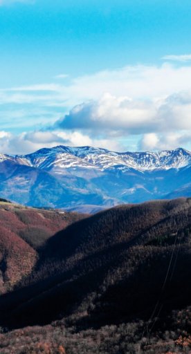
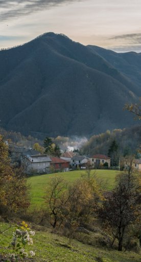
In addition to numerous protected sites, you will find two natural parks of great interest: the Tuscan-Emilian Apennines National Park and the Apuan Alps Regional Park. In these areas, it's possible to choose from a wide range of excursions of varying difficulties: there are trekking routes along the green Apennine ridge, a veritable balcony over the Magra valley, or excursions in the wild Apuan valleys, with incredible alpine scenery.
Since 2015, the Tuscan-Emilian Apennines National Park and the area surrounding it have been declared a MaB Reserve by UNESCO. This recognition aims to protect not only the unique climatic and environmental characteristics of this territory, a natural border between the Mediterranean and central Europe, but also the ability of humankind to adapt and coexist with nature. Tradition is very present in the villages of the Apennines, ancient knowledge is continously passed on and authentic flavors can be tasted. You will be welcomed like family, enjoying unique experiences away from the most popular tourist destinations.
The Regional Park of the Apuan Alps is unique in the world for the geomorphological characteristics of its mountains: not only for the white marble, known to the world as Carrara marble, but also for the numerous karst caves, almost 1000 in total. The industrial history of these mountains, which have been a basin for the extraction of marble for 2000 years, allows those who undertake these paths to travel through history and archeology also.
For more information, we recommend that you contact the Visitor Centers of the two Parks. In addition to qualified personnel and information material for the history of the territory and its unique characteristics, you'll find gadgets and typical products for sale. Above all, you'll find the information and maps needed to organize your excursions. We remind you that you can already start planning your next walk by consulting the online cartography of the National Park of the Tuscan-Emilian Apennines or that of the Regional Park of the Apuan Alps.
In the meantime, here are the five unmissable excursions in the Lunigiana Parks:
-
1.The Bratello Forest - CAI path 00
-
2.The gypsum of Sassalbo and the Camporaghena meadows - CAI path 100 and 100A
-
3.The Vinca Valley - CAI path 175
-
4.The springs of Bagnone - CAI path 116
-
5.The path of Waters and Geosites in Equi Terme
The Bratello Forest - CAI path 00

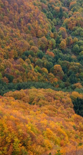
A family walk in the mountains of Pontremoli, on the ridge between the Tuscan-Emilian Apennines and the Ligurian Apennines, that connects two of the entrances to Lunigiana: the Bratello Pass and the Borgallo Pass. Through a fascinating forest of conifers and beech trees, you can reach one of the historic crossroads that has connected Lunigiana with the Po Valley since ancient times. Among the tall trees, you will find several areas equipped for lunches or picnics in the open air, where you can relax in the cool environment.
Characteristics: In the area, there are small, very simple ring routes, that follow mule tracks and dirt roads. Suitable for all ages.
The gypsum of Sassalbo and the Camporaghena meadows - CAI path 100 and 100A

A short walk to connect the Triassic gypsum of Sassalbo with the Camporaghena meadows above: here's a path that reveals the geological, environmental and landscape diversity of the Tuscan-Emilian Apennine National Park. The white rocks are composed of gypsum and salt, deposited by the evaporation of water in the Triassic era. Following paths 100A and 100, a simple circular route will take you to the Camporaghena meadows, open pastures from where the view displays the ridge of Monte Alto.
Characteristics: A short and very simple ring route lasting about 2 hours, suitable for families.
The Vinca Valley - CAI path 175

This itinerary allows you to discover the most authentic Apuan Alps. From Vinca, a place of remembrance for the massacre that took place here during the Second World War, take path number 175 to reach the panoramic grassy expanses of the Foce di Giovo, an excellent observation point over the Lucido Valley and the Apuan peaks. More experienced hikers can return to Vinca via a challenging loop route, continuing in the direction of the Orto di Donna Refuge and then towards the Finestra del Grondilice, a rocky and charming saddle at the foot of the mountain of the same name. After the saddle, the descent towards the Foce Rasori and the Capanna Garnerone begins, a self-catering shelter.
Characteristics: The first part of the path, up to the Foce di Giovo, is suitable for hikers. The next section, (CAI paths 179 - 186 - 183 - 153), which completes the Vinca ring, presents greater technical difficulties and is reserved for experts.
The springs of Bagnone - CAI path 116

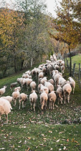
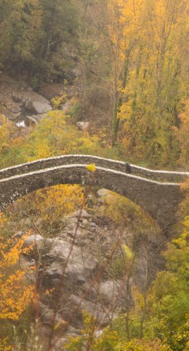
The perfect path for those who want to escape the heat and immerse themselves in a truly unspoiled environment. From the chestnut grove of Iera, a small village in the Apennines, the path leads us into the woods alongside the Bagnone stream. The sound of flowing water accompanies us to the Capanne in Garbia, small bivouacs created from the historic shepherds' huts. The path is all uphill, but there's the possibility of stopping for a dip in the numerous pools or for a photograph at the waterfalls. For those who still want to continue, it's possible to reach the Tornini huts and from here, climb to the summit of Monte Sillara.
Characteristics: The first part of the path, up to the Capanne in Garbia, is suitable for families (with children used to walking about 1h30), the next section presents some difficulties due to the steep difference in height.
The path of Waters and Geosites in Equi Terme

Two easy trails both depart and arrive at the ApuanGeoLab Regional Park Visitor Center, that allows you to discover the environmental and geological wealth of these mountains, even when visiting with family. Along the way, there are springs, wash houses, spas, mills, and also the remains of centuries-old factories and sawmills. In the villages of Equi, Aiola and Monzone, the streets, windows and monuments reveal the geological diversity of our land: from marble, to hard sandstone, to limestone. Alternatively, one of the paths leads to Solco di Equi, a narrow and deep natural canyon along which numerous geosites can be observed, such as the deep moraine of Valtredi or the north face of Pizzo d’Uccello. Keep your eyes peeled: on the surrounding cliffs, you might spot a golden eagle nest!
Characteristics: one of the paths connects Equi to the villages of Aiola and Monzone, with a ring route of about 6 km; the other route joins Equi and Solco di Equi (3 + 3 km). The two routes are simple and suitable for families. For more information click here.


