Trekking through history: 10 places to discover Tuscany
Walking amidst parks, hermitages and parish churches that have fascinating stories to tell about Tuscany
From the parish churches in the Lunigiana to the lost castles among the hills of Siena: traveling through Tuscany on foot often means having the privilege of admiring places that are inaccessible (or almost inaccessible) by car, where the proof and memories of a past, although distant, are more alive and present than ever.
Here are some tips on how to discover landscapes and monuments that are sometimes unknown to tourists, but which have many curious and fascinating stories to tell.
-
1.San Viviano Hermitage
-
2.The Parish Church of San Giovanni and the Tower of Galatrona
-
3.San Salvatore Crypt in Giugnano
-
4.Vallombrosa and the foundations of Florence
-
5.Volterraio Castle on Elba Island
-
6.In the valley of marble
-
7.Rocca della Verruca
-
8.The bridges over the Lima
-
9.Valibona and the Trail of Peace
-
10.Castiglion Che Dio Sol Sa
San Viviano Hermitage

Searching through the names of the saints on a calendar, the name Viviano will not come up. Yet if you ask people from the towns of Vagli Sotto and Vagli Sopra, in the province of Lucca, no one will have any doubts: Viviano is and will always be the patron saint of quarrymen, and the house where he lived and performed amazing miracles is there, dug into the living rock hanging over the Fosso della Tambura.
Today, as it was centuries ago, there aren’t any streets leading to the ancient hermitage: to get there you have to climb up the path that ascends from Campocatino. As a caveat to those who don’t believe something until they see it, along the way there are signs of the miraculous deeds of Viviano: the impression of a hand and foot imprinted on marble, the triple fountain that gushes from the holes which he made by drilling the rock with his fingers as though it were butter, and the wild cabbages that only grow here which sprouted by providence to feed the holy man.
The Parish Church of San Giovanni and the Tower of Galatrona

If you don’t believe the “legend” of the artistic jewels hidden in the folds of what is known as lesser Italy, this is the excursion for you. There is a small one in the village of Galatrona, lost in the countryside of the municipality of Bucine near Arezzo, which seems to have been placed there to quash the doubts of sceptics. The exterior appearance is not lavish and few remember how prestigious the Parish Church of San Giovanni was in previous centuries. Inside, there are three glazed ceramic masterpieces by Giovanni della Robbia: the white ciborium and the aedicule with the image of a saint are remarkable, but the hexagonal baptismal font will leave you speechless!
If you want to enjoy some nature after admiring artistic wonders, all you have to do is walk along the paths that lead up to the Tower of Galatrona, an ancient sentry in a location that is now sought after by lovers of beautiful views and once bitterly contested between the lords of Arezzo and the lords of Florence.
San Salvatore Crypt in Giugnano

You do not need to do a proper excursion to get to the ruins of the centuries-old Monastery of San Salvatore in Giugnano, in the province of Grosseto. There is just under 150 metres of road, but when you get there, it seems as though you have travelled through continents and eras.
To be honest, the monastery is not what it used to be… the harsh weather has destroyed it and the foliage of the trees stands in place of the naves and vaults that were once the pride of the 11th-century Benedictine monks, followed by Cistercian monks and eventually Augustine monks. In the middle of the green floor of the forest, however, you can access the crypt buried three metres below ground and divided into three naves and four columns. A building of great beauty and artistic value was abandoned and that has, paradoxically, made it even more fascinating and almost surreal.
Vallombrosa and the foundations of Florence

With its historic monastery, the perfect field for a picnic and a network of trails all nearby, Vallombrosa is a classic destination for Florentines looking to take a day trip.
The importance of this green space, now protected as a State Reserve, goes far beyond being a place of leisure.
In some ways, it is here where one of the most beautiful cities in Italy has its foundations.
In fact, we would not have the solid splendour of the Palazzo Vecchio, the airy elegance of Giotto’s Bell Tower or the brilliant balance of Brunelleschi’s Dome without the humble firs grown in the silence of the Vallombrosa forests.
The straight, flexible and resistant stems of these trees were in fact the raw material of the scaffolding used for the construction and restoration of the Florentine palaces and make up a large part of the abbey situated about 30 kilometres from the city, which has large wooded areas where monks managed cutting and trading.
Volterraio Castle on Elba Island

A rocky stronghold from which you can almost observe the whole of the Mediterranean, from Bosporus to Gibraltar. This is where the Tyrrhenian Sea could be seen for as far as possible in order to watch over the movements of friends and enemies on the routes that lead to the ports of Tuscany.
This is the Poggio Volterraio, a sentry on Elba Island which, at 394 metres tall, can only be climbed with great effort and sweat.
The castle of the same name stands here, now abandoned, which was the cornerstone of the series of forts around Porto Ferraio for centuries and is the oldest fortress on the whole island. Dating back to the year 1000, the oldest stones are actually still standing today and among the million-year-old dust of the Poggio, a bronze coin from Volterra dating back to the 4th of 3rd century BCE was found, a sign that the Etruscans probably placed an eagle’s nest here to protect their possessions.
In the valley of marble

At every step along the valley that rises from Carrara to the village of Colonnata and up to the Apuan peaks, you hear the story of the “mechanical people”.
Here, the hikes are a continuous weave in and out of corners of great pristine nature and white craters which contain stories of eternal exhaustion and courage.
If you truly want to walk experiencing the truest spirit of this area, before going toward the mountain, take a journey through the tradition of quarries and chisels, visiting the Quarry Museum in the town of Fantiscritti. Then turn around and stroll through the alleys of Colonnata and maybe even allow yourself the luxury of tasting the lard that is enjoyed by foodies nowadays but for centuries was the poor and nourishing sustenance of quarrymen and anarchists in the shrubs.
Rocca della Verruca

An unappealing name, old chipped stones and a spectacular view – you can only get here by taking difficult roads or the easier paths that go through the countryside of the villages at the foot of the mountain.
Nowadays, the Rocca della Verruca (Verruca Fortress) in Calc iis “just” that, at least for the tourists who don’t know its history. However, for people from Pisa, the fortress is a great source of local pride.
Given its height, which presides over the Arno valley and almost overlooks the rooftops of the city, most of the events related to the fortunes of the Tuscan maritime republic (and its fall) have happened here.
Several times over the centuries, the armies of enemies have had to stop at the foot of the unconquerable fortress, and in 1403, with the city already in the hands of its eternal rivals (the hated Florentines, who bought their victory with money when they couldn’t conquer it with arms), the last defenders surrendered there, despite their extreme but useless resistance.
The bridges over the Lima

Below Abetone and up to where the Serchio and Lima stream merge, there is a carved road dug out, amongst the peaks of the Pistoia Apennines, gorges so deep that they become natural borders. Travelling from one side of the river to the other became a challenge that has called upon the intelligence and courage of architects and master builders for centuries.
You can easily see it travelling the paths and roads that line the stream between the municipalities of Piteglio and San Marcelo Pistoiese, where, after a few kilometres, you cross the Lima twice: first on the stunning humped stone bridge, built by Castruccio Castracani in the early 14th century, then over the spectacular pedestrian suspension bridge, built in the 1920s to enable the labourers from Piteglio to get to work at the factories on the opposite side of the stream. The structure has a unique span of 227 metres and a height of almost 40 metres; until 1990 it was the longest pedestrian suspension bridge in the world, a record then overtaken by the Kokonoe Yume Bridge in Japan.
Valibona and the Trail of Peace
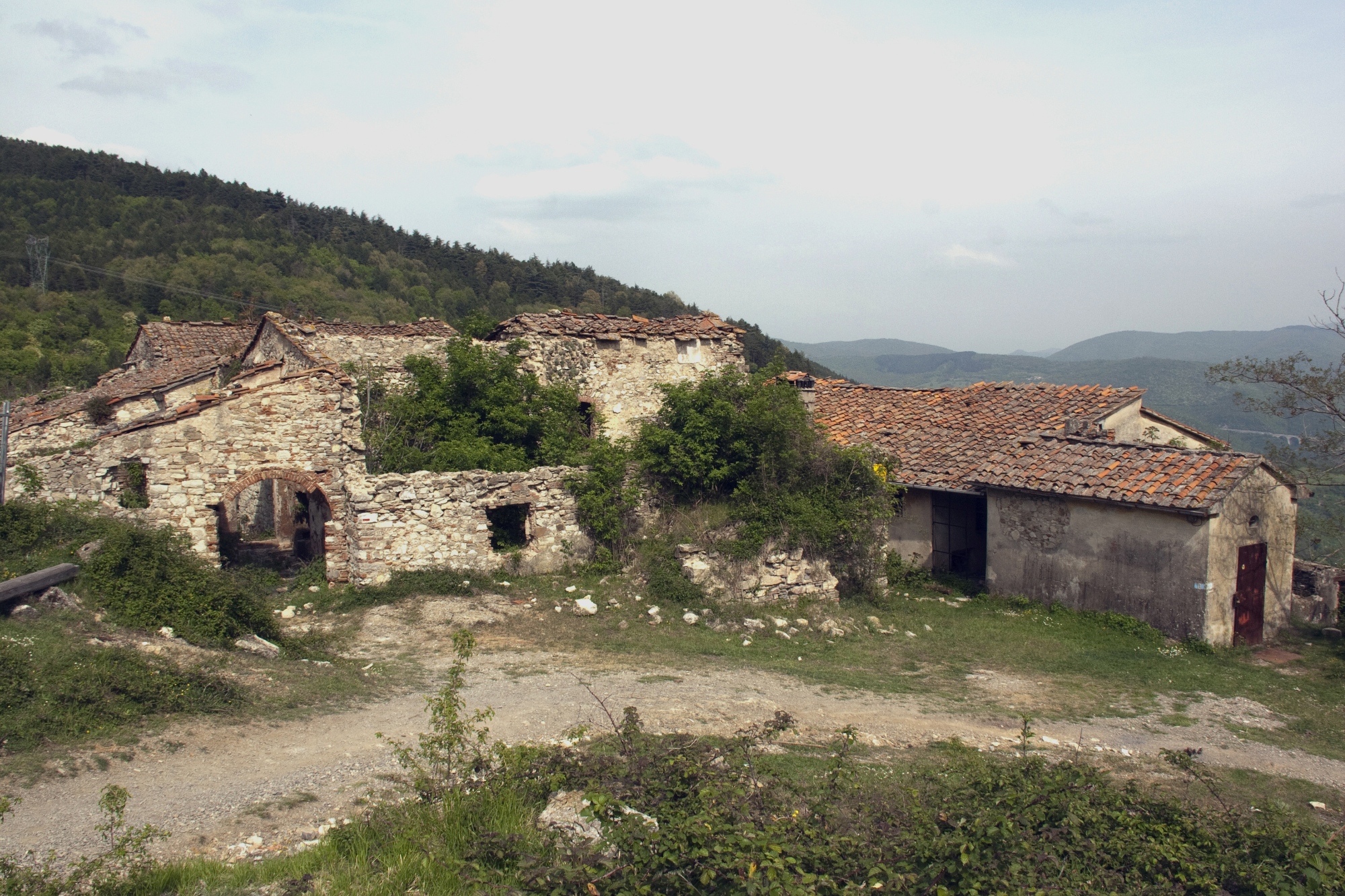
It’s not only artwork and ancient architecture that reminds us of the course of history. In Valibona, a hamlet of the municipality of Calenzano, a few kilometres from Prato, there is a memorial, situated right by a small collection of now-abandoned houses, to show that here, on January 3, 1944, the dispute that marked the start of resistance fighting in Tuscany took place.
The battle saw the “Lupi neri” partisan brigade going up against the republican units from Prato, the voluntary militia Ettore Muti, fascists and Carabinieri from the neighbouring municipalities.
There are no roads that lead to the hamlet and to get there you have to take the hiking route that has the symbolic name of “Sentiero della Pace” (Trail of Peace) and goes up the slopes of Monte Maggiore, which luckily today is a place of beauty and tranquillity.
Castiglion Che Dio Sol Sa

We wanted to capture the sarcastic spirit of the Tuscans by putting a toponym on the map!
Yet when you immerse yourself among the forests of the Alto Merse Nature Reserve, getting there via the trails and unpaved roads that take you to the castle, it’s not difficult to understand why the historic castle, built by the noble Balzetti family and then owned by the Saracini family, is commonly known with the interesting name of “Castiglion Che Dio sol Sa” (Castle that Only God Knows).
There are not many written documents about the origins of the castle. We only know that the fortress was under the jurisdiction of Siena in 1200. This is proven by a “fine” imposed by the municipal administration on the lords of the place for not sending the infantrymen required to reinforce the army.
Little else is known about this fortress, imposing and equipped, lost in the greenery of the Tuscan countryside. Maybe it’s better this way: everyone gets the chance to imagine for themselves the stories of armies, ladies and knights and what happened behind the walls of the Castle that Only God Knows…


