Four lakes tour


Within the drainage basin of the Serchio river there are as many as 12 artificial reservoirs for hydroelectric power generation, small dams and large lakes that characterize the landscape of the valley.
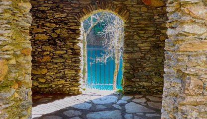
We start from Castelnuovo di Garfagnana, a crossroads of roads and the main center of the valley, taking the Strada d'Arni (Provincial Road 13) famous among two wheels lovers because it has been the stage of the Giro d'Italia several times. Slightly and steadily uphill, skirting the Turrite Secca stream, we arrive at Isola Santa. Seen from the dam, the ancient stone village is reflected in the emerald waters of the small lake and definitely deserves a refreshing stop.
Once we go beyond Isola Santa, we take the wide intersection of the Via Monti Mare on the right which, with wide hairpin bends and a much steeper climb, takes us to Capanne di Careggine from where we continue, for several kilometers on flat ground, with spectacular viewpoints over the group of the Panie.
The profile of the Omo Morto looms sharply in front of us and, having reached the Passo di Scala, a stop is mandatory. Having passed the Maestà della Formica at an altitude of 1.000 meters, we take provincial road 69 in the direction of Careggine. The village welcomes us with narrow carriage ways perched around the chiesa di San Pietro (church of St. Peter) and, with a small detour from the route, we can reach the Big Bench on the hill of Monti. The view sweeps from the Apuan Alps to the Apennines and gives us a splendid view of Lake Vagli.
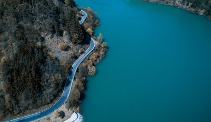
Back in the village, we descend with wide hairpin bends to Poggio, from where we will follow provincial road 50 to Vagli. The dam that bars the course of the Edron stream is an impressive 92 meters high and its crown is accessible to the public. With its 34 million cubic meters of water, Lake Vagli is the largest hydroelectric reservoir in Tuscany and hides in its depths the village of Fabbriche di Careggine, which comes back to life for a summer only when the reservoir is emptied. We skirt the lake for about 4 kilometers to the locality of il Bivio, where the climb to Giovetto begins. Campocatino, the old shepherds' pasture, lying on the edge of the large meadow at the foot of Mount Roccandagia, is worth a short detour from the route. Back at the pass we descend to Gorfigliano and Gramolazzo where Mount Pisanino, the highest in the Apuan chain, is reflected in the green waters of the artificial lake. Popular with fishermen and bathers, Lake Gramolazzo is skirted by a beautiful bike path and a boardwalk equipped with a pier and a small beach.
We face the last easy ascent to the Castagnola tunnel and then encounter, in succession, Piazza al Serchio, San Romano in Garfagnana, Sillicagnana and Villetta, leaving the provincial road at the junction for Pontecosi to reach the last lake of our tour. The small lake, formed on the Serchio river, is an ideal resting and wintering place for numerous aquatic avifauna, including coots and wild ducks of various species that can be found the shallow waters around the reed beds. We return to the provincial road from the medieval bridge that has the shape of a donkey saddle that leads to a short uphill paved stretch and end the path with the inevitable passage through the historic center at Castelnuovo di Garfagnana and its elegant Rocca Ariostesca.