The tour of the mountain and the Spanish Fortresses of Argentario


In this Mount Argentario bike tour, we will explore a place suspended between land and sea, discovering its historic and natural beauties.
The itinerary starts in Terra Rossa, at the far end of the dam joining Mount Argentario with Orbetello. Following the directions for Porto Ercole, we ride along the bicycle path that runs facing the western lagoon, along the provincial road of Porto Ercole (Provincial Road 2). We proceed to the junction for Feniglia, and once we ride beyond it the bike path passes by Poggio Pertuso, reaching Cala Galera and the first dwellings of Porto Ercole.
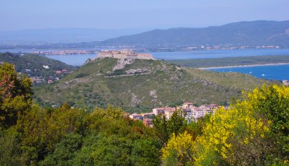
Once we finish the bike path, we enter the village on ordinary roads, taking a break at the pretty little port, nestled between the Rocca Spagnola (Spanish Rocca) and Forte Filippo (Fort Filippo). Before tackling the hairpin bend that climbs the hill on which, between the 13th and 16th centuries, the Republic of Siena first, and the Spaniards later, built and rebuilt the Rocca, we find the gateway to the historic center of the village and the small square with the Governor's Palace. With a short uphill climb, the Panoramica di Porto Ercole provincial road (Provincial Road 66) leaves the town, continuing halfway up the hillside among pine trees and Mediterranean scrub, with spectacular views of the sea. After about 1,5 kilometer, the possible detour at Forte Stella (Fort Stella), strategic bulwark of the Spanish defense system, consisting of an outer quadrangular fortress enclosing an inner bastion with a characteristic six-pointed star plan. The view on the whole of the Costa d’Argento is majestic, from the squadre in front of the fort.
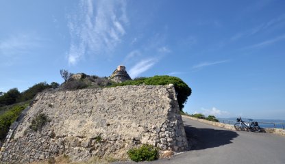
We move forward, climbing the last kilometer of the Provincial Road Panoramica with stunning views of the sea. Once the provincial road ends, a short, steep downhill stretch begins. The itinerary continues on private roads of free passage, which become unpaved for a stretch of about 4 kilometers circumventing Punta Avvoltore, until it rejoins the asphalted pavement near Torre Ciana. The view sweeps over the open sea, with the islands of Giannutri and Giglio in the foreground. Amid continuous ups and downs, we reach the lowest point of the itinerary at 40 meters above the sea of the footpath that descends to the picturesque Cannelle beach. The road now climbs sharply again, for a stretch characterized by steep and narrow hairpin bends.
We keep climbing, with wide curves and some hairpin bends that give way to the bends, in a wild environment where the Mediterranean scrub gives way to olive groves and dry stone walls, until we reach the top of the hill at Capo D'Uomo. We now proceed downhill taking, on the left at the next intersection, the panoramic road to Porto Santo Stefano (Provincial Road 65). Once past the hairpin bend at the intersection with Residence Cala Piccola, a very pleasant descent begins. With new views opening up at every bend, you pass the paths that branch off the provincial road to the characteristic coves on the western side of Argentario, Cala del Bove, Cala dei Gessi, Cala Moresca and Cala Grande. At the entrance to Porto Santo Stefano, we stop for a break at the Fortezza Spagnola (Spanish Fortress) that dominates the gulf of the town. Taking the last few curves of the Panoramica, we arrive at the harbor of the important fishing village: it is from Santo Stefano, in fact, that the regular ferries leave for the islands of Giglio and Giannutri.
From Porto Santo Stefano, our bicycle touring loop begins to close, not before crossing a stretch of road reserved for bicycles and public transportation, which uses two tunnels dug into the rock of the old Orbetello Scalo - Porto Santo Stefano railway, thanks to which we reach the Pozzarello cove and then ride along Provincial Road 161 to the Santa Liberata bridge, at the beginning of the Giannella tombolo (a strip of land about 6 kilometers long). Having passed the Santa Liberata intersection, we pay attention when facing the lane change that gives us the opportunity to enter a bike-pedestrian path that, skirting the lagoon, accompanies us to the dam of Orbetello.