Trekking in Rossano Valley at the discovery of ancient finds of the rural past
The Rossano Valley is located in the Municipality of Zeri, an area made up of several valleys divided by physical and morphological borders, but still united by historic crossing points and millenary traditions.
Here once, and sometimes still today, life was marked by the alternation of the sun and the moon, by the seasons and by agricultural and livestock activities. Here and there, buried by piles of rubble, forgotten by time, surrounded by brambles and the advancement of bushes, ancient testimonies of the rural past of these areas can still be admired and appreciated.
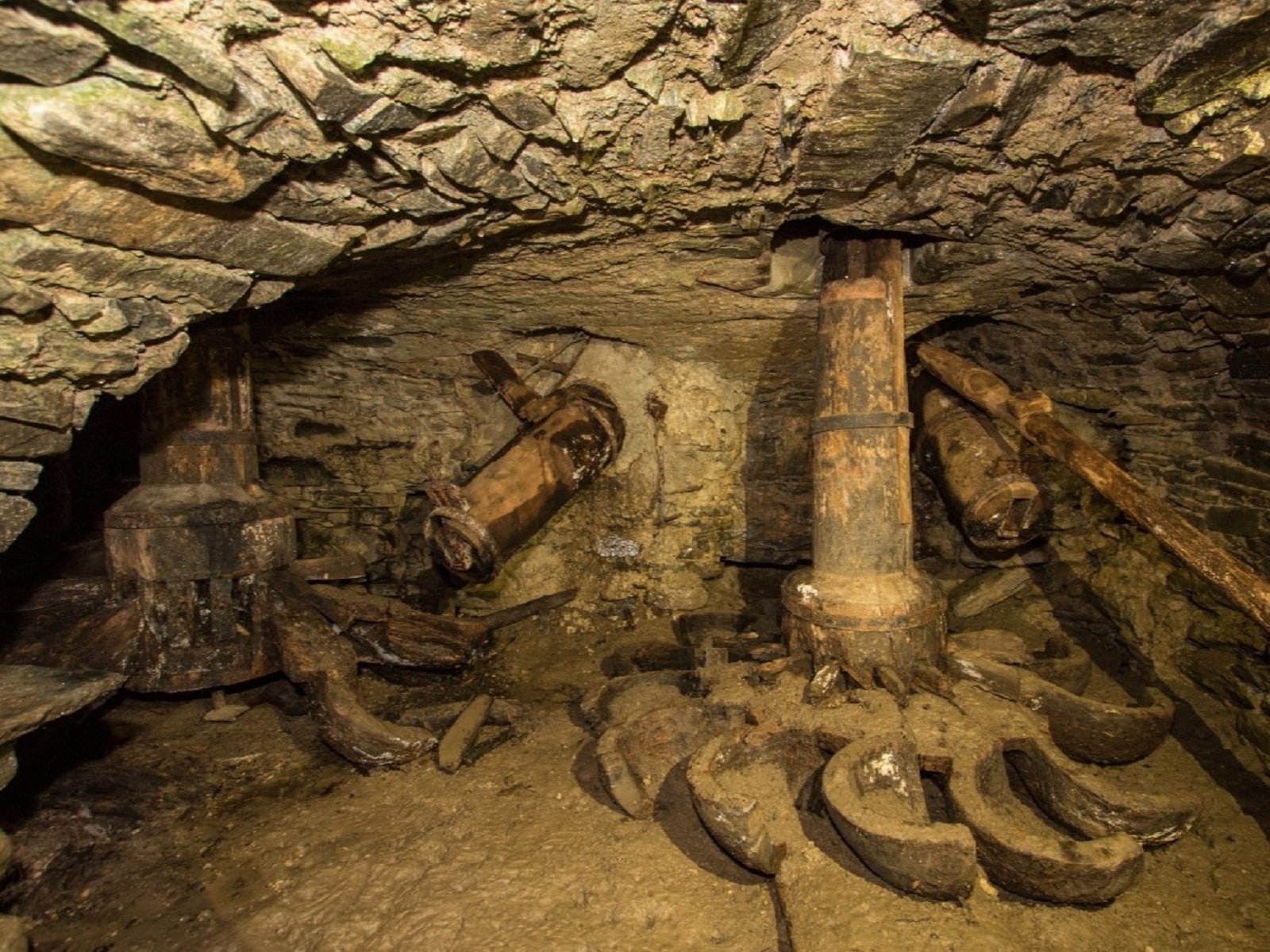
The water from the Teglia stream was in fact used, with clever canalization systems and basins, to drive the gears of the mills which led to the movement of the millstones to produce different types of flour. The person in charge of this activity was the miller, a figure who has now almost disappeared, who often lived in the same building with his family, who was directly involved in all the operations of the mill.
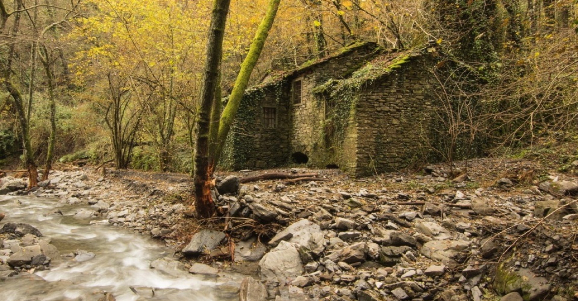
In particular, dotting the course of the stream, hidden in the valley floor, you can recognize stone bridges and 5 mills, one of which has recently been renovated. Going in search of these structures is taking a journey through time, trying to interpret the forms and functions of these ruins that are hidden among piles of stones, scattered millstones and roofs that are now tired of performing their function.
The Mills route in Rossano

The route starts from the hamlet of Chiesa di Rossano, reachable in 40 minutes by car from Pontremoli, passing through Arzelato. You can park near the Chiesa oratory and immediately take the mule track which in a few dozen meters leads to the cemetery. Near the cemetery, you can easily see the white and red signs of the TL (Trekking Lunigiana) and the indications of the Rossano 3 hiking itinerary, arranged by the Pro Loco.
We continue downhill past the Colla district and through two gates that delimit grazing areas (you are always advised to open and close the gates, paying particular attention to any grazing animals and loose dogs). Always following the red-white signs, in a few minutes on the path you reach the valley floor where, at an ancient single-arch bridge, you cross the old road. Turning left and walking along the Teglia stream, you reach a further bridge and the first mill further downstream (crossing the bridge you can continue the Trekking Lunigiana route, reserved for expert hikers).
The itinerary of the mills, however, goes back up the course of the stream and always staying on the unpaved road at the bottom of the valley, to discover the second and third mills adjacent to the watercourse. In the rear part of these ruins, you can still see the water collection basins that guaranteed and controlled the flow of water, while near an entrance portal there is the inscription 1883, testifying to the last era of gold of these artefacts.
Still following the road, you arrive at the fourth and last mill recently renovated (in fact, the fifth mill, historically attested, is currently not very visible, prey to degradation and vegetation). In the land around the structure you can see several millstones, also recovered from other mills.
Continuing along the unpaved road, you arrive at the asphalted road. From here, to complete the excursion you must turn right at the intersection between the unpaved road and the asphalted road, always following the asphalted with little traffic, to arrive first at the hamlet of Paretola and then at Chiesa di Rossano.
In case of rain, caution is recommended due to uneven and slippery ground.